
|
AIA Teams Up with Google to Launch New Architecture Layers in Google Earth AIA’s 150th anniversary celebrated through 3-D images
The America’s Favorite Architecture layer features the American public’s favorite structures, as selected by an independent poll of the public announced earlier this year. Google Earth users can now see many newly created 3-D models of the ballparks, bridges, buildings, and memorials that characterize architecture for Americans and comment on the poll results. By clicking on the America’s Favorite Architecture layer, users can view textured 3-D images of the nation’s most popular landmarks created with Google SketchUp, right down to the trees lining the sidewalks and flags flanking the entrances.
“The AIA partnership with Google Earth reinforces the message that architects and local citizens are part of a growing global effort to create a better quality of life in their community,” said AIA President RK Stewart, FAIA. “By following the Blueprint for America projects as they are completed over the course of the next year, local citizens everywhere can find inspiration and insight into how they might become active or more effective in their community.”
“We’re delighted that the AIA community is sharing their important work with new audiences in Google Earth,” said Michael Jones, chief technologist for Google Earth and Google Maps. “The AIA layers in Google Earth enable users to visualize, understand, and appreciate the world around them better.” For more information on the AIA and Google Earth, visit www.AIA150.org, or watch the AIA/Google Earth YouTube video. |
||
Copyright 2007 The American Institute of Architects. All rights reserved. Home Page |
||
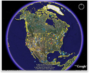
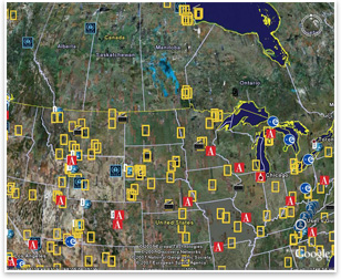 The Blueprint for America layer documents community service efforts funded by the AIA, in which AIA members donated their time and expertise to collaborate with community leaders and local citizens to address issues such as homelessness, sustainable communities, and downtown revitalization. Clicking on the Blueprint for America layer enables users to explore how AIA members and local citizens are working together to resolve real issues in their communities to create a vision for their future. The Blueprint projects are demonstrations of AIA civic engagement and foster an understanding of how citizens can find their voice to address specific issues related to the design and planning of their community to help create a better future.
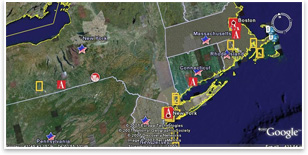 A passionate partnership
 Google’s intelligent drawing system
news headlines
practice
business
design
Watch AIA President RK Stewart, FAIA, and Google Earth’s Chief Technologist Michael Jones demo the AIA/Google Earth launch on YouTube. (3 min., 30 sec.)
Join AIA Executive Vice President/CEO Chris McEntee as she outlines the launch of the AIA’s layers on Google Earth. (60 sec.)
Watch AIA/Google Earth's "America's Favorite Architecture" Tour on YouTube, featuring a fly-by of the 3-D models of the 150 favorite structures created with Google’s SketchUp.
(4 min., 34 sec.)
To view the AIA’s layers on Google Earth:
1. Download Google Earth.
2. Open the Google Earth software.
3. Go to the “Layers” pull-down menu on the left.
4. In the View box on top, choose “Core.”
5. Under “Primary database,” click open “Featured Content” (with the blue star).
6. Click on American Institute of Architects (with the Big Red A).
7. Go to the globe on the right and play!
To learn more or download Google’s SketchUp—Google’s 3D modeling software in free and pro versions—visit Google’s SketchUp Web site.
To read FAQs on the partnership of AIA and Google Earth, visit the AIA Web site.