|
Seven Projects Receive 2007 Honor Awards for Regional & Urban Design
by Heather Livingston
Contributing Editor
Summary: The recipients of the 2007 Institute Honor Awards for Regional & Urban Design “showed concern for repairing mistakes of the past, improving the quality of the urban environment, and creating sustainable places,” praised the jury. “A lot of the submissions defined and articulated important issues, but what set these award-winning projects apart were innovative, clear, and insightful solutions to those problems.” Of the seven selected projects, four are on the densely packed East Coast. The remaining three are in Dallas, Milwaukee, and Napa, Calif.
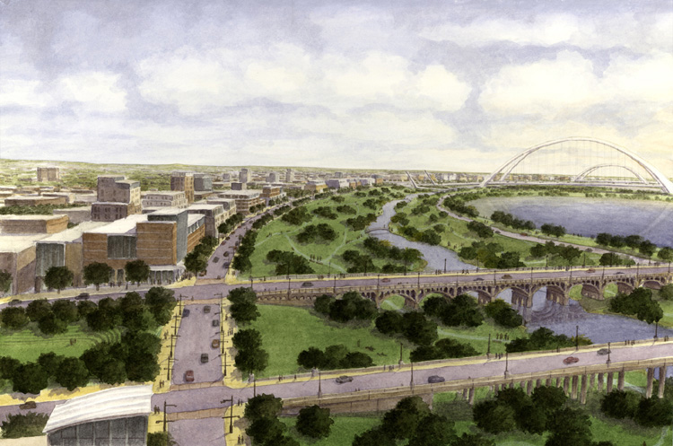
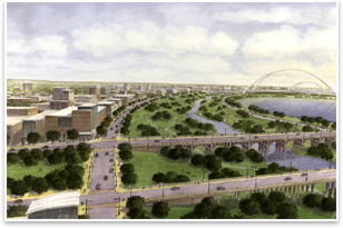 Project: A Balanced Vision Plan for the Trinity River Corridor Project: A Balanced Vision Plan for the Trinity River Corridor
Location: Dallas
Architect: Chan Krieger Sieniewicz Inc.
Client: City of Dallas
The Balanced Vision Plan began as a privately funded initiative that sought to ensure the City of Dallas would achieve the fullest potential of a massive and complex, multi-agency project. However, city staff, state and federal agencies, consultants, and citizens joined the effort to complete the study, resulting in a plan with broad support for the city’s long-range plan and vision. The plan provides a large urban recreation park; a river with restored sinuosity instead of the current artificially straightened channel; a sensitively designed road that runs concurrent against the downtown levee and affords park and city vistas long-term flood protection through levee improvements, parks, and trails; and several hundred acres of community development along the Trinity River Corridor. “We were impressed by the vast scale of this proposal,” said the jury. “They’ve taken a significant physical and environmental barrier and transformed it into a regionally scaled public domain that stitches together the surrounding urban areas and unifies the city.”
Rendering by Chris Ritter.
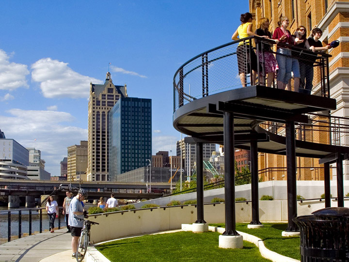
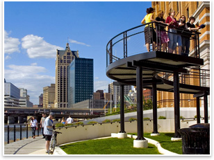 Project: Historic Third Ward Riverwalk Project: Historic Third Ward Riverwalk
Location: Milwaukee
Architect: Engberg Anderson Design Partnership Inc.
Client: Historic Third Ward Association and Business Improvement District #2
The river that cuts through the district had been previously underused. The district representatives wished to provide green space and riverfront amenities for residents, visitors, and business owners. The Historic District decided in 1999 to develop a plan for a three-quarter-mile-long Riverwalk that would connect the area to the more formal downtown Riverwalk. A master plan, based on the design concept of a public artist, was developed to reflect the neighborhood’s historic past and artistic present and future. An excellent example of urban renewal, it transformed a forgotten riverfront into a green, vibrant destination that provides recreational opportunities, improved image, longevity, reduced maintenance, and stormwater management. “This project responds to the many different conditions along the urban river’s edge,” praised the jury. “It captures the rugged, gritty complexity of the historic buildings and the many conditions along the river and features rather than homogenizes them.”
Photo © Ellen Pizer.
 Project: The Carneros Inn Project: The Carneros Inn
Location: Napa, Calif.
Architect: William Rawn Associates, Architects Inc., with Caspar Mol Architecture and Planning, Persinger Architects (formerly Persinger Hale Architects), RMW architecture & interiors, and Les Girouard
Client: Carneros Partners
Located between the Sonoma Valley and Napa wine regions, in the heart of the Carneros region, this new 27-acre inn and town center is designed to engage with the broader community while serving as “base camp” for visitors exploring the surrounding areas. The site is composed of four neighborhoods and includes a town center; guest cottages; for-sale courtyard houses; and the hilltop, which contains a restaurant, reception building, and spa complex set atop a commanding view. The site was designed to make a positive impact on the local community and environment. The project is geothermally heated, and all of the stormwater is processed and reused for on-site irrigation. The jury appreciated that “the clear design carries through very consistently from the site plan, through the architecture, into the landscaping design and details. It is regionally contextual in its relationship to the site topography, spatial hierarchies, and the scale of its architectural and landscape elements.”
Photo © Mark Hundley.
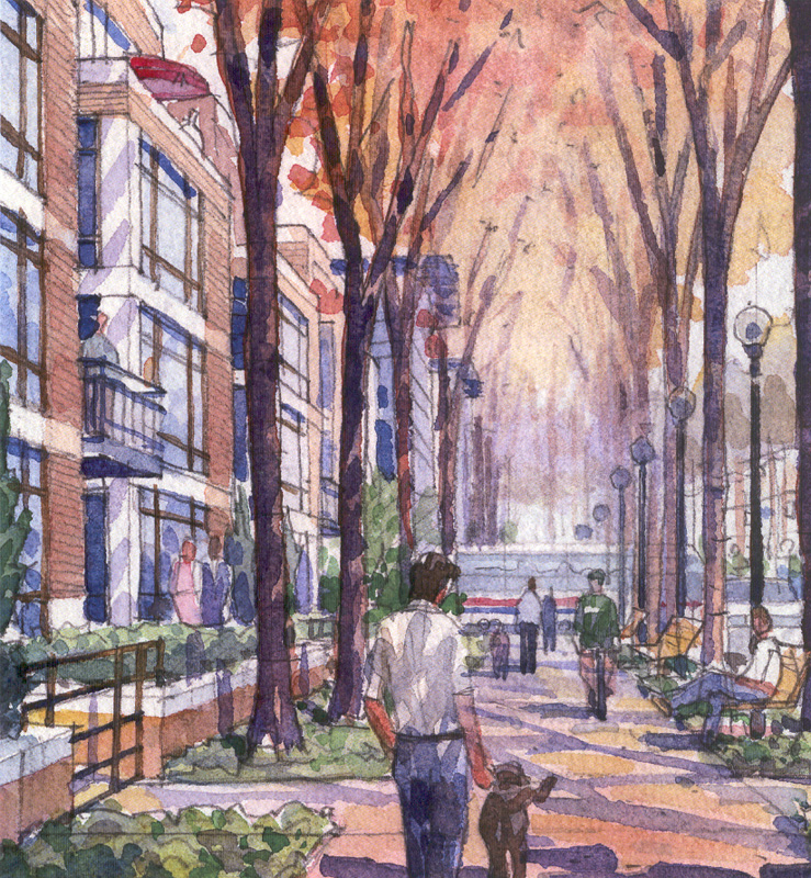
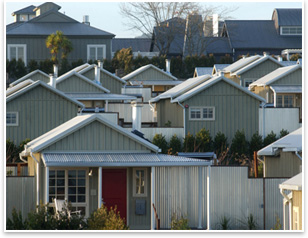
 Project: Crown Properties Project: Crown Properties
Location: Gaithersburg, Md.
Architect: Ehrenkrantz Eckstut and Kuhn Architects
Client: KB Home
This project on the outskirts of Washington, D.C., attempts to create a new paradigm for a suburban community. The overarching goal was to create a sustainable, financially feasible, vibrant, and healthy suburban development. The urban design and implementation strategy provide development standards where sustainability plays a central role in enhancing quality of life, transportation choices, and placemaking without hurting its financial targets. Located on 180 acres of land, the development includes more than 2,500 units of various housing types, 350,000 square feet of commercial/retail space, community facilities, and a 30-acre biotechnology high school. The parks and open space constitute more than 40 percent of the total land area. The jury called this “the most comprehensive submittal in terms of identifying key urban design principles and strategies for the creation of the 21st century sustainable city. It is an excellent model to be used for the redevelopment of worn suburban sprawl.”
Image courtesy of the architect.
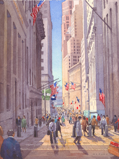
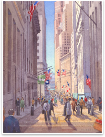 Project: New York Stock Exchange Financial District Streetscapes + Security Project: New York Stock Exchange Financial District Streetscapes + Security
Location: New York City
Architect: Rogers Marvel Architects
Client: New York City Economic Development Corporation
The program for this project is to provide perimeter security in the streets of Lower Manhattan’s financial district that protect the iconic institutions while improving the quality of public spaces. The goal was to provide state-of-the-art security technology for one of the world’s most visible terrorist targets without making the area appear under siege. Through careful coordination and direct communication with multiple stakeholders, city agencies, and designers of varied expertise, the comprehensive strategy knits together the cultural, historical, and financial landmarks with the security plan. “This is an elegant solution to a thorny contemporary problem,” praised the jury. “This approach addresses security as a neighborhood-wide design matter rather than as a building perimeter issue. In doing so, [it] contributes to the creation of a pedestrian-friendly, high-quality public realm, while taking a very full environmental approach to the problem.”
Photo © Michael McCann.
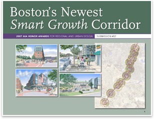 Project: Boston’s Newest Smart Growth Corridor: A Collaborative Vision for the Fairmount/Indigo Line Project: Boston’s Newest Smart Growth Corridor: A Collaborative Vision for the Fairmount/Indigo Line
Architect: Goody Clancy
Client: The Fairmount/Indigo Line CDC Collaborative
Four neighborhood CDCs came together to shape a vision for new transit-served urban villages within metropolitan Boston. The main purpose of their endeavor was to enhance rail service in an area that has one of the highest poverty rates in the region. In a long stretch of the corridor that lacks train stations, 91 percent of the people are of color, almost half of the households don’t own a car, and there is no direct bus service to downtown. An enhanced rail line will unlock opportunities for higher-density affordable housing, better access to jobs in Boston and along the line, and a greenway linking a series of parks in the corridor. The CDCs are in the process of acquiring property and will soon begin development at several planned sites. The jury called this project a “powerful grassroots vision to improve people’s lives. It lays the groundwork for a lot of future events to happen on a solid infrastructure.”
Courtesy of the architect.
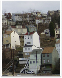 Project: Zoning, Urban Form, and Civic Identity: The Future of Pittsburgh’s Hillsides Project: Zoning, Urban Form, and Civic Identity: The Future of Pittsburgh’s Hillsides
Location: Pittsburgh
Architect: Perkins Eastman
Client: Department of Planning, City of Pittsburgh and the Allegheny Land Trust
The aim of this project is to make recommendations for replacing zoning guidelines with specific regulations that maintain the character and identity of Pittsburgh’s hillsides. Although its hillsides are one of Pittsburgh’s dominant features and provide aesthetic, environmental, and recreational benefits, they hadn’t been protected. The zoning controls in place were ineffective in regulating development and the city’s natural resources were viewed as commodities rather than public assets. The study’s recommendations call for distinguishing hillside development from other urban patterns by reinforcing hillside character at the city, hillside settlement, and property scales. The recommendations will maintain continuity of the natural landscape with development in a subordinate and supportive role. “[The] methodology is very clear and comprehensive, looking at natural patterns, built form, legal constraints, and pressures for future development,” praised the jury. “The study reveals how Pittsburgh’s hillsides are an integral component of the character of the place and identifies them as a local treasure while laying guidelines for treating this treasure in a manner that enhances their viability.”
Courtesy of Perkins Eastman/The Buncher Company.
|